
Article by:
Ma. Cristina Arayata
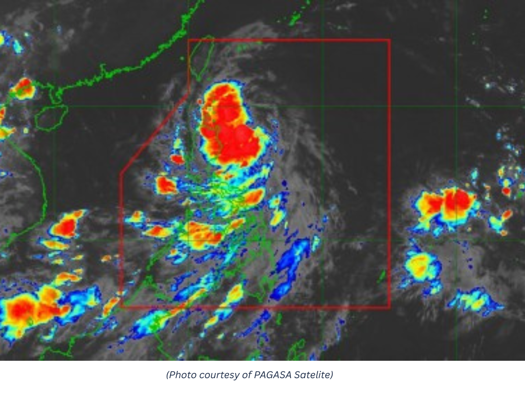
MANILA – Tropical Storm Kiyapo intensified Friday, prompting the hoisting of Tropical Cyclone Wind Signal No. 2 over parts of Northern Luzon, the state weather bureau said.
The Philippine Atmospheric, Geophysical and Astronomical Services Administration (PAGASA) said Kiyapo was packing maximum sustained winds of 65 km per hour near the center and gusts of up to 80 kph.
As of 4 a.m., the storm was located 345 kilometers east of Aparri, Cagayan, moving west-northwest at 30 kph.
Signal No. 2 remains in effect over Batanes; the northern portion of mainland Cagayan (Santa Ana, Gonzaga, Santa Teresita, Buguey, Camalaniugan, Aparri, Ballesteros, Abulug, Pamplona, Sanchez-Mira, Claveria and Santa Praxedes), including the Babuyan Islands; and the northern portion of Ilocos Norte (Pagudpud).
Signal No. 1 is in effect over the rest of mainland Cagayan, Isabela, Nueva Vizcaya, Quirino, Apayao, Abra, Kalinga, Mountain Province, Ifugao, Benguet, the rest of Ilocos Norte, Ilocos Sur, La Union, and the northern and central portions of Aurora (Dilasag, Casiguran, Dinalungan and Dipaculao).
PAGASA said Kiyapo's circulation and the southwest monsoon are generating strong to gale-force winds across most of Luzon and the Visayas, as well as Zamboanga del Norte and Davao Oriental.
A gale warning remains in effect over the northern seaboard of Northern Luzon.
PAGASA said Kiyapo is forecast to pass near the northeastern portion of mainland Cagayan before passing very close to or making landfall in the vicinity of the Babuyan Islands later Friday.
The cyclone could further intensify into a severe tropical storm while traversing extreme Northern Luzon after passing the Babuyan Islands, PAGASA said.
Heavy rain is forecast over Batanes, Cagayan, Apayao and Ilocos Norte due to Kiyapo.
The southwest monsoon is also expected to bring heavy rains over Palawan, Occidental Mindoro, Antique, Iloilo, Guimaras, Negros Occidental and Negros Oriental. (PNA)
 Log in with Google